Showing posts with label Travel. Show all posts

Monday, 19 September 2016

Touring Mont Blanc on foot


One day in 1981 - half a lifetime away - I began my walk around Mont Blanc. My companion was Bob Kyte, a man both taller and calmer than me. Our aim was to complete the Tour du Mont Blanc - a circular walk of 170 kilometres, through the outermost reaches of France, Italy and Switzerland. Our walk started in the village of Les Houches, at a railway station on the line to Chamonix, and then headed via mountain trails and cols to Courmayeur in Italy, Canton Valais in Switzerland, and then back into France and Les Houches. The hardest part of the walk involved plodding up the zig-zag paths which led from one valley to another. I discovered that Bob, with his long legs, could do this much faster than me. However, my shorter legs triumphed on the downhill stretches. The finest stretches of walking were along ridges and hillsides, such as those leading from France into Italy, and the high walk along and above the Chamonix valley. There were splendid views of the great mountain and its glaciers. Across the valley, you could hear the gunshot-sound of the ice cracking.

We slept in small hotels and hotel dormitories, barns and mountain refuges. The most Spartan was the refuge at the Col de la Croix du Bonhomme at just under 2500 metres above sea level. This rose like a gaunt ruin through the mist. Sleeping was in bunk beds in a mixed dormitory. Everybody slept in their clothing. The toilet was a shed a little down the hill, with a hole in the rock. But there was a hot meal of vermicelli soup, and I slept well. The next day we slept in the best accommodation: the far more luxurious Rifugio Elizabetta Soldini, across the border in Italy. This was warm, had comfortable bunk beds, civilised toilets, good food, and stupendous views.

On the way, we met the people of Europe: two Basque lads in a shelter above a gully of snow; a middle-aged Swiss couple with a rather camp son; and numerous jolly Belgians. Before we began the walk, Bob and I took a bus into Chamonix. Our fellow-passengers included a group of German walkers, dressed in a sort of walking uniform. As they looked with delight at the mountains around them, they began an enthusiastic song. The rest of us in the bus looked on with embarrassment. But with hindsight, I believe the German were right - the beauty of the Alps can not be described with words, only with poetry and song. I do, however, have some photos taken by Bob.


Sunday, 8 May 2016

Wigmore - from Castle to Hall


One Saturday last month, I went on a road trip with my wife, my daughter and her friend Emma. We travelled Westwards from my village of Martley in Worcestershire, over Bringsty Common, through Bromyard and Leominster, and along quiet roads to the village of Wigmore in Northern Herefordshire. Like Martley, Wigmore has a rural high school, a garage, a shop, a pub and a castle. But whereas Martley’s pub is closed, Wigmore has the utterly splendid Castle Inn, with excellent food, good beer and a welcoming host. The castles in the two village also differ. Martley has an iron-age fort -  now just a series of mounds around a burial ground on top of a conical hill which dominates views of the village. Wigmore, by contrast, has a vast ruined castle that was once the power-base of the man who for three years was de facto King of England.  

That man was Roger Mortimer, first Earl of March. In 1322, he led a failed uprising against King Edward II and was imprisoned in the Tower of London, from which he escaped to France. There he met Edward’s Queen Isabella and they became lovers. In 1327, they led an army of invasion and ousted the king, who they later had murdered in Berkeley Castle. Roger and Isabella then ruled England in the name of Isabella’s son, the 14 year old Edward III. But in 1330, the young Edward organised a small group of knights to make a surprise raid on Roger, who was captured and promptly executed. Even mediaeval kings would have baulked at executing their mothers, so Edward had Isabella exiled to Castle Rising castle in Norfolk.

The Mortimer lineage ceased with the death of the 5th Earl in 1425, after which the Castle became ruinous and passed to the Harley Family of nearby Brampton Bryan . In 1643, it was owned by Sir Robert Harley, who was MP for Herefordshire and a supporter of Parliament against King Charles I. Sir Robert feared that the Castle could be used as a stronghold by the King’s forces, and so had it systematically demolished. There are now just great jagged broken walls on a high wooded ridge, with windows that look over the wide valley of the Upper Teme.

Despite the ruination of their property in Herefordshire, the Harley Family prospered. Sir Robert’s grandson was another Robert, who was chief minister under Queen Anne and was rewarded with the title of 1st Earl of Oxford and Mortimer. When the Queen died, he was impeached by the new Parliament and imprisoned in the Tower of London for two years. His son, the 2nd Earl, engaged in property speculation, buying farms to the North West of London. These were laid out as urban streets, which is why this small area of London now has an Oxford Street, Mortimer Street, Henrietta Street and Cavendish Square (both named after the Earl’s wife Lady Henrietta Cavendish), Margaret Street (named after his wife’s mother), Wimpole Street (after the estate in Cambridgeshire inherited by his wife), and Wigmore Street. Wigmore Street is famous for the Wigmore Hall, a major concert venue for chamber music and lieder. I suspect that very few of those who go to concerts at the Hall know that it is ultimately named after a ruined castle in Herefordshire.

Thursday, 3 March 2016

The lost great houses of Worcestershire


Downton Abbey may be fiction, but it is accurate in showing how the great country houses of England once dominated the countryside, socially, politically and economically. They were an expression of the elevated status of their owners, and the centres of the social and political life of their county and in some cases of the nation. Their owners were the employers of numerous servants, the landlords of extensive acres of local farms, and the valued customers of many rural shops and traders. The local churches (often located in the grounds of the country houses) were shrines to the families that dominated them, with rows of elaborate statues and memorial plaques to each aristocratic generation. The imprint of these families was found in pleasure as well as death - many local pubs and hotels bear their name and coats of arms.

As in fiction, this all changed in the first half of the 20th Century, as the great houses were demolished, transferred to the National Trust, or otherwise disposed of. Farms were sold to pay off debts, and the people living in the English countryside became commuters to nearby towns instead of dependents on their local great house. This is an astonishing social change, little commented on by historians. To try and understand the scale of this,  I looked at the great country houses owned by aristocratic families in Worcestershire at the start of 1900, and what has happened to them since.

My researches are incomplete, but I have been able to identify four earls, one viscount and one baron who at the start of that year had their main country seat in the County. These were:

▸    George William Coventry, the 9th Earl of Coventry, who owned Croome Court, South-East of the City of Worcester. This was one the most important great houses in England, having the first garden ever designed by Capability Brown. In 1900, the Earl held various senior political appointments in the Royal Court, was Lord-Lieutenant of the County and later in that year became Colonel-in-Chief of the Worcestershire Regiment. In the Second World War, Croome Court became the residence of the Dutch royal family and a military base for research on radar. The Coventry family sold Croome in 1948, and it is now managed by the National Trust.

▸    William Humble Ward, the 2nd Earl of Dudley, who lived in Witley Court in the North-West of the County. This was a vast and beautiful palace that had once been the home of Dowager Queen Adelaide. The Earl later became Lord-Lieutenant of Ireland and Governor-General of Australia. In 1928, he sold Witley Court, which burnt down in 1937. This is now a spectacular ruin, maintained by English Heritage. 

▸    Robert George Windsor-Clive, the 1st Earl of Plymouth, who lived at Hewell Grange, a great house he ordered built in Tardebigge in the North-East of the County. The Earl was a former Lord Mayor of Cardiff and had been Paymaster-General in the Government, and was later to become First Commissioner of Works. In County society, he was Lieutenant-Colonel of the Worcestershire Yeomanry. Hewell Grange was sold and became a borstal in 1946 and is now a prison.

▸    William Lygon, the 7th Earl Beauchamp, who lived at Madresfield Court, near Malvern. This was built in the 16th Century, with subsequent extensions. In 1900, the Earl was Governor of New South Wales, where he became unpopular after making several undiplomatic remarks. He later became a cabinet minister and supported several progressive causes until he was outed as a homosexual in 1931. The title became extinct on the death of the 8th Earl in 1979. Madresfield Court is still owned by the Lygon Family and is not open to the public.

▸    Charles George Lyttleton, the 8th Viscount Cobham (and also the 5th Baron Lyttleton), who lived at Hagley Hall in the North West of the County. This is a fine 18th Century building with an excellent garden, and is still the home of the present 12th Viscount. The 8th Viscount had been an MP for East Worcestershire before succeeding to the title, and lived at Hagley Hall. His predecessor, the 7th Viscount promoted settlement in New Zealand, where the City of Christchurch has a Hagley Park and a port of Lyttleton. 

▸    Augustus Frederick Arthur Sandys, 4th Baron Sandys, who lived at Ombersley Court, a fine 18th Century house North of Worcester. The Sandys are an ancient family with a long record of public service, but I have not been able to find much information about 4th Baron. The present 8th Baron is also the Marquis of Downshire, who inherited the Sandys title from a distant cousin, and may live in one of his other properties.

There were of course many other great houses in Worcestershire in 1900, occupied by wealthy landowners who not members of the aristocracy. They included the Chateau Impney (now a hotel), Hanbury Hall (now National Trust), Hindlip Hall (now a police headquarters), Lea Castle (now demolished), Stanford Court, and Westwood House (now split into flats).

So, as far as I can tell, Viscount Cobham is the only descendent of all these aristocrats who  still lives in his historic country seat. This is no easy undertaking with such an old building. In an article in the Birmingham Post in 2013, the Viscount estimated that it costs £200-300,000/year to maintain Hagley Hall. I wish him all success - I have happy memories of watching a performance of The Barber of Seville in the long gallery of the Hall.

Friday, 15 May 2015

Dead whale-watching in Iceland


People now prefer to watch whales instead of eating them. But I ate whalemeat a long time ago, and the only whales I have ever seen were dead ones being hacked to pieces in Iceland. This all happened in 1966, when I spent a summer in Reykjavik as a trainee placed by AIESEC - an international organisation which arranges what would now be called ‘internships’ for economics students.

I flew out of Birmingham Airport (then called ‘Elmdon Airport’) on the day of the World Cup Final. The passengers crowded round a transistor radio in the departure lounge to hear the match. I spent the first week staying with an Icelandic family, where I ate quite a lot of fish. After that, I moved to lodgings with some other AISEC trainees in a house with a young landlady. I was based in a firm called ‘Kassagerdin’, which made boxes (mainly for fish) as well as printing all sorts of materials. I began working in the office, working on a complex accounting machine. But later, I had a far  better time on the workshop floor as a member of a three-man team operating a large machine which cut and printed cardboard boxes. The two other workers were the teenage son of the firm’s owner and a teacher working over the summer school break.

The AISEC committee in Iceland did an excellent job, and the group of trainees went on various trips to see the vast volcanic landscape of Thingvellir, the Arbaer Folk Museum, the waterfall Gullfoss, the Great Geysir, and Hveragerdi (where we saw bananas grown in greenhouses heated by hot thermal springs). I took a few days off on holiday to hitch-hike around the coast to Akureyri and from there to the Lake Myvatn. I was given lifts by many friendly and interesting Icelandic people. These included the driver of an articulated oil tanker. At one point on the journey, he turned off the road, and drove the truck along a track through the twisted rocks of a lava field until we came to a half-built bungalow. He unloaded some long planks he had stored along the side of the trailer, placed them next to the bungalow, and then returned to the main road. He was building this house himself, he explained, for his retirement. Later that day, I checked into a hotel in the village of Blonduos. I slept in the hotel annexe, built on the edge of a beach of black sand facing the Arctic Ocean.

Before all this, however, I paused in my journey at Hvalfjordur, just North of Reykjavik. In 1966, the road would around the head of the fjord - the location of a whaling station. From my memory, this comprised a jetty, a slipway and a large shed. The jetty had originally been built by the US Navy, and several Icelandic spectators pointed to the ‘secret American submarine base’ around the coast. Eventually, a small whaling boat approached the jetty with (I think) two whale carcasses slung on each side. The first carcass was winched to the slipway, and as it rose on the slope a mass of blood swelled out into the sea. Some young men, stripped to waist, climbed on the body of the whale and began hacking it to pieces with large long cleavers. In a short time, there was just bones, meat and entrails. There was also the smell - a smell so strong I remember it now almost 50 years later.

Also 50 years later, the Hvalur Whaling Company still operates in the same location, still catching fin whales and bringing them to a whale-abattoir in a fjord named after whales.

Wednesday, 15 April 2015

Coffee with cold milk in Telemark

I spent the Summer of 1967 on a traineeship with Norsk Hydro in Oslo. This was arranged with an international organisation called AIESEC, which at that time organised unpaid placements (they would now be called ‘internships’) with employers in different countries for students studying economics or commerce. My first AIESEC placement had been in the previous year with a small printing company in Reykjavik, where all the employees knew each other by sight. Norsk Hydro was a very different enterprise. It was the largest industrial enterprise in Norway, involved in mining and metal-processing, chemicals and fertilisers, and oil. I was based in its headquarters, and supervised by a kindly man called Mr Falkenberg. I stayed at first in the University student village, and later in a room in the Eastern suburbs. I visited the Viking ship museum, the Munch museum and the Holmenkollen ski jump. I swam in lakes and walked through the woods that surrounded Oslo. I also spent a lot of time strolling round the City centre, and was surprised to find that its citizens enjoyed eating in open-air cafes and drinking excellent coffee. Neither of these activities were common in England at that time.

Part of my traineeship involved a tour round the various industrial sites in Southern Norway that were operated by Norsk Hydro. Mr Falkenberg drove, and we stayed in hostels owned by the company. One of the places we visited was Rjukan in Telemark, located in a deep-sided valley. In the Second World War, Norsk Hydro had been taken over by the German company IG Farben, and had produced heavy water, important in the production of nuclear weapons. Norwegian commandos destroyed this facility in 1943.

After we left Rjukan, Mr Falkenberg steered the car along a heavily-potholed mountain road, which eventually led to a rather alpine-looking hotel. We stopped for coffee and a cake. There was a strange atmosphere in the place. After we left, Mr Falkenberg expressed his disgust with the hotel’s owners, who had been notorious collaborators with the German forces. The local authority took its revenge by refusing to repair the road leading to the hotel. What made matters even worse for Mr Falkenberg was the way the hotel served its coffee: “No cream with it”, he said, “not even warm milk - just cold milk”. Ever since then, I have associated coffee served with cold milk as fit only for Nazi collaborators.

Sunday, 29 March 2015

The ring-doughnut of unvisited places


In this country, my wife and I travel to two sorts of places. There are those we can get to and back easily in a day, and those sufficiently far away to require one or more overnight stays. The ones we can visit in a day form a sort of circle around our house in West Worcestershire. The limits of this circle to the North are Birmingham and Solihull, where we visit family. Any further North requires a trip up the grim M6 through the Black Country, and is therefore avoided. The limit to the East is Oxford, which we can reach by (a very slow) train. To the South, our limits for a day-trip are Gloucester and the pleasant market-town of Cirencester, while to the West we go over the Welsh border as far as Llandrindod Wells and Welshpool.

Places which require an overnight stay such as London or Devon are of course about a 100 or more miles away. But between the circle of day-trips and the wider area of overnight-stays is a ring-doughnut-shaped area that we never usually visit. These are places just too far to travel to and from with pleasure in a day, but too close to justify booking and paying for a hotel. In our case, this ring-doughnut of unvisited places includes many locations with much to offer - places like Wiltshire, the Thames Valley below Oxford, Derbyshire, and inland mid-Wales.

Anyway, my wife and I decided that the time has come to visit places within the ring-doughnut, and last weekend we headed for a two-night stay in Lacock, about 75 miles from our home. Lacock is a very picturesque village owned by the National Trust - so picturesque in fact that (together with Lacock Abbey) it has been used as a setting for about 50 films and television programmes. The day we arrived, there was shooting for Downton Abbey just along the street from our hotel. The square in front of the parish church was arranged to look like a country market-place in the 1920s, with cows, sheep and pigs, local extras in hats and long coats, and a vintage van. Most of the shooting seemed to involve standing around, with very brief intervals of action. I wonder how many minutes of television time resulted from the two days of filming.

Our inn in Lacock was the Sign of the Angel - a wooden-frame building said to date from the 1400s. There are low beams, huge fireplaces and creaky wooden stairs. The floors on the ground-floor had stone flags - those in the bedrooms on the first floor pitched in all directions. The inn too has been a filmset - for one of the Harry Potter stories. We ate excellent meals (and especially breakfasts) at the Sign of the Angel, and slept well in one of the inn’s five bedrooms. On the Saturday, we visited Lacock Abbey and the Fox-Talbot museum of photography (named after one of the main inventors of photography who lived in the Abbey). We also took a train to Bath.

We discovered that one of the joys of holidaying in the ring-doughnut of unvisited places is that we are in no hurry to drive there and back. So on the way, we stopped at Stow-in-the-Wold, saw Lechlade and visited Avebury - a village enclosed in a vast prehistoric stone circle and embankment. On the way back, we stopped at Newark Park. This is a much-expanded Elizabethan hunting lodge on the top of the Cotswold Edge, overlooking the wide Severn Valley. This is probably the only British stately home to be restored by a gay American ex-servicemen.

Thursday, 4 December 2014

A bar in La Herradura

There came a point in the life of our family when we could afford to go on holiday to a villa with a swimming pool. So in April 1994, we flew to Malaga, picked up a hire-car, and drove to a villa on a hillside overlooking the sea near the village of La Herradura. After a week there, we moved for the second week to a villa in a quiet street near the centre of Nerja. This was a happy time. My children were nine and five years old, and were full of curiosity and excitement. The villas were excellent, and the surrounding area has many fascinating places to visit. My wife and I could lie on our bed in the villa at La Herradura at night, and look out across the sea at the distant flickering lights of fishing boats. We travelled to Frigiliana (a beautiful white village full of flowers), visited  the Alhambra, threw snowballs at each other on the Sierra Nevada, wandered round the old city of Almuñécar, and travelled through the white mountainside villages of Las Alpujarras. We visited the caves of Nerja and strolled along the Balcón de Europa. We ate fresh fish cooked in a small café on the beach.

One day I walked down to the village centre of La Herradura, and went into a local bar for some beer. Sitting against the bar, smoking, was a gloomy-looking Englishman. He told me he was not on holiday, but was a local resident. “I left England because the country’s going to the dogs”, he said. “It’s full of bloody immigrants. They don’t learn our language and don’t learn our ways”. “Do you speak Spanish”, I asked a little later. “No, never bothered”, he replied.

The next week in Nerja, I saw a more impressive example of the English abroad. It was clear that the town had a substantial population from North-West Europe. The British had contributed to the culture of the place in a positive way. There were some pleasant cafes selling salads, tea and cakes, and an English-language bookshop. An English-language  newsletter reported meetings of ramblers (walking in Winter rather than Summer), a local history group and an animal welfare society. The British residents were essentially re-creating the middle-class life of their home country in a foreign land. But their very success in this task may have impeded their participation in the general life of Spanish society. Did the English immigrants to Spain ‘bother’ to learn Spanish? The magazine advertised Spanish classes, but it is hard to become fluent in a second language, particularly when you start learning late in life.

I too was struggling to learn Spanish. On the last week we stayed in Nerja, I saw a big headline in one of the Spanish papers. I translated it to read that Ayrton Senna was dead. ‘That can’t be true’, I thought. 'I must have made a mistake'.

Monday, 17 November 2014

How church buildings learn


From where I am sitting in my house, I can see through the winter trees to our parish church. St. Peter’s Church in Martley was built in the 12th Century, from red sandstone, quarried nearby. The church was extended in phases over the next 200 years, with a fine tower added in the mid-15th Century. The latter contains a ring of six great bells, cast on the site in 1673. It is claimed that these are the oldest complete set of bells in England. At some time after the Reformation, pews and an West gallery were added to the church, but these were removed when the church was restored in 1909. What remains after all these changes is a standard medieval English village church, made of local stone, shaped like a long box with a tower at the West end. From a stroll round the building, between the ancient gravestones, it is easy to see how parts have been added and taken away over the centuries.

The church at present is warm and welcoming. More important than that, it exudes a sense of holiness, accrued from generations who have prayed and voiced the liturgy. Despite the nine centuries of its existence and the many changes in the styles of worship over that time, the parish church serves its purpose well.

Eight miles away, the Church of England is demolishing a much younger building. Holy Trinity and St Matthew’s in Worcester was built in 1965, in what was then a fashionable circular form. Problems accumulated with the building. There were boiler failures, condensation and leaks. The church closed for worship in 2012 after part of the roof collapsed. The Parochial Church Council found that it would have cost half a million pounds to fix the building, and decided on demolition and replacement.

A faulty round church built in the 1960s is a minor example of crapitecture, but it also illustrates the wisdom of Stewart Brand, set out in his great book How Buildings Learn: What Happens After They’re Built . Brand proposed that buildings should be made from low-cost, standard designs that people are familiar with, and which can easily be modified. People are then able to gradually change their buildings to meet their changing needs. Martley parish church is an example of a simple design (a stone box with a wooden roof) that was a widely-understood standard design for a small church in the Middle Ages. Bits were added over the centuries. If Martley had grown into a town instead of remaining a village, aisles would have been added and the roof raised. Perhaps the nave would have been lengthened. All of this would have been carried out by skilled stonemasons who occasionally experimented, but usually employed tried-and-tested methods.

Brand contrasted his preferred approach with that used in much of architecture today. The modernist idea that ‘form follows function’ (ie buildings should be designed according to how they should be used) is wrong because the functions of all buildings change (often before construction is completed). Designing a building for a specific set of functions can thus impede necessary adaptation. The use of exciting new materials and techniques may win architectural prizes, but it makes the building an experiment in which its occupants become the guinea-pigs. The round drum-like building of Holy Trinity and St Matthew’s was designed for a specific purpose and could not easily be adapted. It used new techniques which failed to keep the building dry. Let us hope those who design its replacement learn from church buildings which have stood for 900 years.

See also: A guide to crapitecture

Sunday, 7 September 2014

In Coromandel

The Coromandel is a long peninsula in the North Island of New Zealand, named after a ship named after a coast in India. The ship was built in 1798 in Calcutta for the East India Company and named the ‘Cuvera’. She was bought by the Royal Navy in 1804 and converted into a warship as HMS Malabar. After action in the West Indies, she was converted two years later into an armed storeship. In 1815, she was re-named as HMS Coromandel, and was fitted out to transport convicts to Australia. To make this voyage less costly to the Exchequer, she was refitted again to enable her to carry a return cargo - in this case, timber from the tall straight kauri trees of New Zealand. In 1820, HMS Coromandel called at a small harbour on the North Island to load lumber, and gave its name to the harbour, the small town that developed around it and eventually the entire peninsula.

My wife and I visited Coromandel in 2010, as part of a family holiday. We drove from Rotorua, up the coast of the Bay of Plenty, and then across to Coromandel town by the unsurfaced (and rather exciting) 309 Road through the deepest wooded hills. We stayed in the Gold Miner’s Cottage on a hillside overlooking the vast Hauraki Gulf. The cottage had a secret: behind the sofa was a door, which opened into the old goldmine. A short way along, there were glow-worms.


Goldminers in the Coromandel have now been replaced by artists and people seeking an ‘alternative’ lifestyle. One such incomer in 1973 was an Englishman, Barry Brickell. He set up a pottery collective North of the Town, but found that he needed to fetch clay and timber (for fuel) from up the hill. The answer was to build a 15-inch gauge railway. This was slowly expanded over the next quarter of a century to become a public attraction. Now called the ‘Driving Creek Railway’, it zig-zags up the steep slope, through tunnels and over bridges through kauri plantations. The line ends high above the pottery at an large octagonal wooden building with vast wide views over the tops of trees and across the Gulf. More than 30,000 people visit the Railway each year, showing the enduring attraction of scenic railways - even ones built in the recent past. It is bizarre that New Zealand, like Great Britain, destroyed many of its scenic railway lines because they were  not profitable. Perhaps it was just that the wrong people were running them.


There are many other things to see in the Coromandel, and details are at this website:
http://www.coromandelfun.co.nz/

Monday, 4 November 2013

Fireworks in Vancouver


There are moments in your life when your senses are especially acute and which always remain in your memory. One such moment for me was sitting on a beach in the dark in West Vancouver in 2000. That summer, I attended an international academic conference in Seattle. I brought my wife and children with me to expand the conference into a family holiday. We found cheap flights to Vancouver, hired a car, and explored the Vancouver area before driving South of the border to stay in the University District of Seattle. After the conference, we returned North via a ferry to Sidney on Vancouver Island, travelled up the Island and then returned via the Sunshine Coast to Vancouver. This was followed by a circular tour around a small part of the Lower Mainland.

But the first part of the holiday coincided with the Celebration of Light - an international firework competition held every year in Vancouver. We watched from one of the beaches (Dundarave Park or Millennium Point?) on the North Shore. In the dark, we could just see other spectators, all quietly sitting and watching the fireworks on the other side of the dark waters of English Bay. While we watched, we heard a vast freight train, half a mile long, slowly rumbling out on the railway line behind us. We then saw it in the flashes of the fireworks. The train was heading from the City’s docks, going West so that it could go East. After passing West Vancouver, it would have headed North past the Coast Range, past Whistler, and by daylight would have reached the rail junction at Prince George. From there, it might have headed on Canadian National tracks East to Winnipeg and Chicago, carrying the good of the Orient across the continent.

Tuesday, 11 June 2013

My holiday home in Ruritania

I went earlier this month with my wife to see Coppélia, performed by Birmingham Royal Ballet. This was a great experience, and reminded me so much of our beloved holiday home in Ruritania. As I am sure you know, Ruritania is located in the heart of Mitteleuropa. We do not have a coastline, but there is a varied landscape of lakes, mountains, fields of golden wheat, and dark mysterious forests. Our holiday home is in a picturesque village (all the villages in Ruritania are picturesque), full of timber-framed houses with projecting eaves and crooked chimneys. Along the street, there is the village ale-house, outside which many of our jolly peasants sit drinking and laughing. From time to time, they jump up and start dancing enthusiastically. Across the street from the ale-house lives a comical old inventor, who builds lifelike dolls with ingenious clockwork mechanisms to move their arms and legs.

There are few motor vehicles or trains in Ruritania, but many elegant horse-drawn carriages. Nor is Ruritania influenced by modern fashions: all our peasants wear elegant well-cut clothes, brightly-coloured, with cloaks, boots and hats. The local aristocracy are particularly well-dressed: the wife of the local prince is strikingly beautiful and is said to be violently jealous of any woman who is deemed more lovely.

Life in Ruritania is not all feasting and dancing, however. Few venture out into the forests at night. It is rumoured that young men who have been unfaithful and thereby caused the death of their lovers are haunted by their ghosts and forced to dance until they expire from exhaustion. Some say that at night the swans in the lake near our village turn into beautiful young women. Children who walk alone through the forests seem particularly at risk, and there are disturbing tales of them being chased by wolves or lured by evil old women promising gingerbread - a local delicacy.

When in Ruritania, my wife and I usually visit one or more of the local castles. One near our holiday home was abandoned about 20 years ago and is now completely overgrown with giant brambles. A more interesting castle just up the valley is the home of ancient line of counts, though these are rarely seen around the place during daytime. We have also visited the capital city Strelsau, which is of course the home of Ruritania’s royal family. Some people say the king looks a bit like me, but it would be a work of utter fiction if the two of us were ever confused.

Saturday, 8 December 2012

A short walk in France: best memories


When you are feeling down or just bored, review your best memories - the ones that make you smile with recollection. If you could plot these on a personal timeline, you would find they form clusters - a few days of your life which produced many great memories. One cluster in my life was a week’s walk in South West France along a footpath called the GR6. This took place in - I think - September 1980, when I travelled by train and ferry to Sainte-Foy-la-Grande in the Gironde, and then walked to Les Eyzies-de-Tayac in Périgord. I had a small tent and stayed in campsites and once in a cheap hotel.

This was my first trip to France, and I discovered not just that I could understand French, but also that the French I met in the small towns and villages on the path were friendly, kind and hospitable. The path was easy to follow, and led across a rolling landscape of vineyards, woodlands and riverbanks. The weather was dry and hot.

My best memories of this trip included:

▸    Walking in the crisp early morning through the centre of Paris from the Gare du Nord across the Seine and the ÃŽle de la Cité to the Gare d’Orléans. The streets were being watered, the boulangeries were opening and there was a smell of fresh bread and French tobacco. Like so many before me, I fell in love with Paris.

▸    I walked over the open hills near Bergerac to the splendid Chateau of Monbazillac, surrounded by vineyards. I decided to go on a guided tour. For the first time in my life , I tasted the original and greatest of the sweet white wines of France. I sat stunned by the experience. I shall drink Monbazillac again this Christmas.

▸    One evening, I walked into the small village of Lanquais. I went to the café to ask if there was anywhere I could pitch my tent. After some discussion, the locals decided I could camp on the touchline of the rugby pitch and use the club showers and toilet. I pitched my tent, left my backpack in it, and went back to the bar. I bought a meal and a drink and chatted to an old man called Josephe. I bought him a whisky, and he invited me back to his home, which was a room under the town clock. There we shared a meal of pig’s trotters. The next day, I returned to the café for breakfast and set off for the next day’s walk.

▸    One day, I walked through a quiet wood of tall trees. In the middle of the day, I sat down to rest in a clearing. I heard a shrill bird call, and, looking up, saw a snake eagle circling high above me. After my rest, I walked downhill until I came to a chateau, abandoned and shuttered, being reclaimed by the woods.

▸    Another day (or perhaps the same day), I walked into a hamlet of old stone houses, all in the honey colour of this part of Périgord. There was a small café open. I was the only customer. I ordered a glass of red wine, which came with a glass of water. The wine was better than many you find in expensive restaurants in England. I left feeling benign but reinvigorated.

▸    At the end of the walk, I came to the prehistoric caves at Les Eyzies. A very old man showed me round, and was careful to point out the genitalia on each of the stick men drawn on the walls of the cave 16,000 years ago. Some of the local inhabitants still live in caves, in houses built into the rock, facing the wide and beautiful River Vezere. See the photograph above.

In 1984, recently married, my wife and I went back to this Les Eyzies as part of a holiday in the Dordogne. But that is a different cluster of best memories.

Wednesday, 28 November 2012

French exiles, royal and presidential in Worcestershire

Look up a list of pretenders to the thrones of Europe and you will find that France has three: from the Bourbon; Orleanist; and Bonapartist lines of succession. Each of these royal houses ruled France at different times in the 19th Century. When not in power, the senior members of each house would go into exile, often in England and, in a few cases, in Worcestershire.

The royal exile first to reach our county was Lucien Bonaparte, Prince Français. He was a younger brother of Napoleon and played a key part in the latter’s rise to power. But he lost out in palace intrigue, and was exiled to Italy. In 1809, he decided to flee to the USA, but his ship was intercepted by the Royal Navy. Once in England, Lucien seems to have been treated with great civility, and was allowed to buy a house in Worcestershire, although he was kept under close surveillance and his mail was intercepted. The house, called ‘Thorngrove’, is in a secluded part of Grimley Parish not far from the River Severn, and was built in the 18th Century. It has large landscaped gardens and is Grade 2 listed. Lucien eventually left Thorngrove in 1814, although not before one his sons, Louis Lucien Bonaparte, was born in the house. Thorngrove House is not open to the public, and so, although it is only a few miles from my home, I have never visited it.

After the fall of the Second Empire in 1870, France became a republic almost by default. Although monarchists won the elections for the National Assembly, the three competing royal houses could not agree on an acceptable candidate for the throne.

The next royal exile in Worcestershire was the Duc d’Aumale, one of the sons of King Louis-Philippe, who ruled France between the two revolutions of 1830 and 1848. The Duc bought Wood Norton Hall near Evesham in 1872 as a hunting lodge. On his death in 1897, the property passed to Prince Philippe, Duc d’Orleáns, who was the official pretender for the throne on behalf of both the Bourbon and Orleanist royal houses. Philippe rebuilt Wood Norton Hall as a splendid stately home in a wooded setting overlooking the River Avon. The house became an important social centre, with a royal wedding for the Bourbon family in 1907 (the bride was the grandmother of the current King of Spain). Philippe had an active social life too, being cited as a co-respondent in a divorce case and having an affaire with Dame Nellie Melba.

Philippe died in 1926 and the house eventually passed to the BBC for use as an emergency broadcasting centre in the Second World War and in the Cold War (with a nuclear bunker added), a staff training centre, and the location for some early Doctor Who episodes. A few years ago, I had a superb meal at Wood Norton Hall, followed by coffee and petits fours in a dark lounge lit only by an oak fire. The building is now a luxury hotel and worth visiting for its food, its setting and its history.

The next important French exile in Worcestershire was a future president rather than a would-be king or emperor. After the defeat of France in 1940, General de Gaulle created the Free French Army. In 1942, he set up training school for officer cadets in Ribbesford House near the beautiful riverside town of Bewdley. Although not based there, he visited the House and the town before the School closed in 1944 and its newly-trained officers joined in the liberation of France. Half of them were dead before the end of the War.

Ribbesford House probably dates from the 16th Century but has been much enlarged, partially demolished and restored since then. It is not open to the public, but can be seen from the nearby parish church. It is perhaps a little reminiscent of a French country chateau, standing in front of a wooded hill, facing fields leading to a long winding river. The river flows past villages and towns to join the great ocean where all rivers meet. 

Monday, 29 October 2012

Sailing to Switzerland


On the 23rd August this year, my son Andrew and I sailed to Switzerland. We had not intended to do so. Our original plan for our holiday was to fly to Milan Malpensa, hire a car and drive to Stresa on Lake Maggiore. The next day, we had intended to drive to Locarno or points North, and then spend the next few days in Austria. But on the day before we were due to leave, I realised that I had lost my driving license. Andrew has not yet passed his driving test, and so car hire became impossible. The flights were already booked, and so we decided to backpack. Two trains from Malpensa got us to Stresa, where we stayed two nights. Then we took a steamer up the Lake to arrive at Locarno quayside in the early afternoon. Three nights in Locarno included a trip to the extraordinary castles of Bellinzona, and a train journey along the valley West of the city to the hilltop village of  Intragna. Another train journey took us back to Italy and the town of Como, where we spent one night before returning home.

Travelling by boat and train meant that I had more time to look at the scenery, and note the sharp change crossing the border. Stresa is a beautifully-preserved resort town, with great hotels lining the lake front. The town centre is full of narrow pedestrian streets leading to a town square full of restaurants. Italian restaurants seem incapable of cooking bad meals, and we ate better in Stresa and later in Como than anywhere in Locarno. The enjoyment of food in Switzerland is of course lessened by the price you have to pay for it. When we arrived in Intragna, we found it almost deserted - the only place open was the small Hotel Stazione. We went through to the back and found we were the only customers in a splendid restaurant with a view down the valley to Locarno. Andrew ate Gnocchi and I ate Risotto ai Funghi. Both were the finest we had ever eaten, and we were not put off our food by the constant sound of gunfire. The waiter explained that this was from the firing range used by the Swiss Army on its summer training.

On reflection, it is not so unusual to arrive in Switzerland by steamer. Many years earlier, our family had travelled across Lake Geneva by ferry from Evian-les-Bains in France to Lausanne. That was a happy time too.

Saturday, 3 March 2012

The discovered country


The best part of a touring holiday is arriving at a place not in the guide books, and finding it to be beautiful and unique. I have had many such experiences. I remember a holiday in Brittany with my wife when my son Andrew was young enough to be in a pushchair. We passed through the small market town of Quintin on the way back from somewhere else, and stopped. We found streets of fine old houses and a chateau. At the chateau café, looking out on the gardens and the river, a well-dressed lady took a liking to Andrew, and fed him Madeleine cakes.

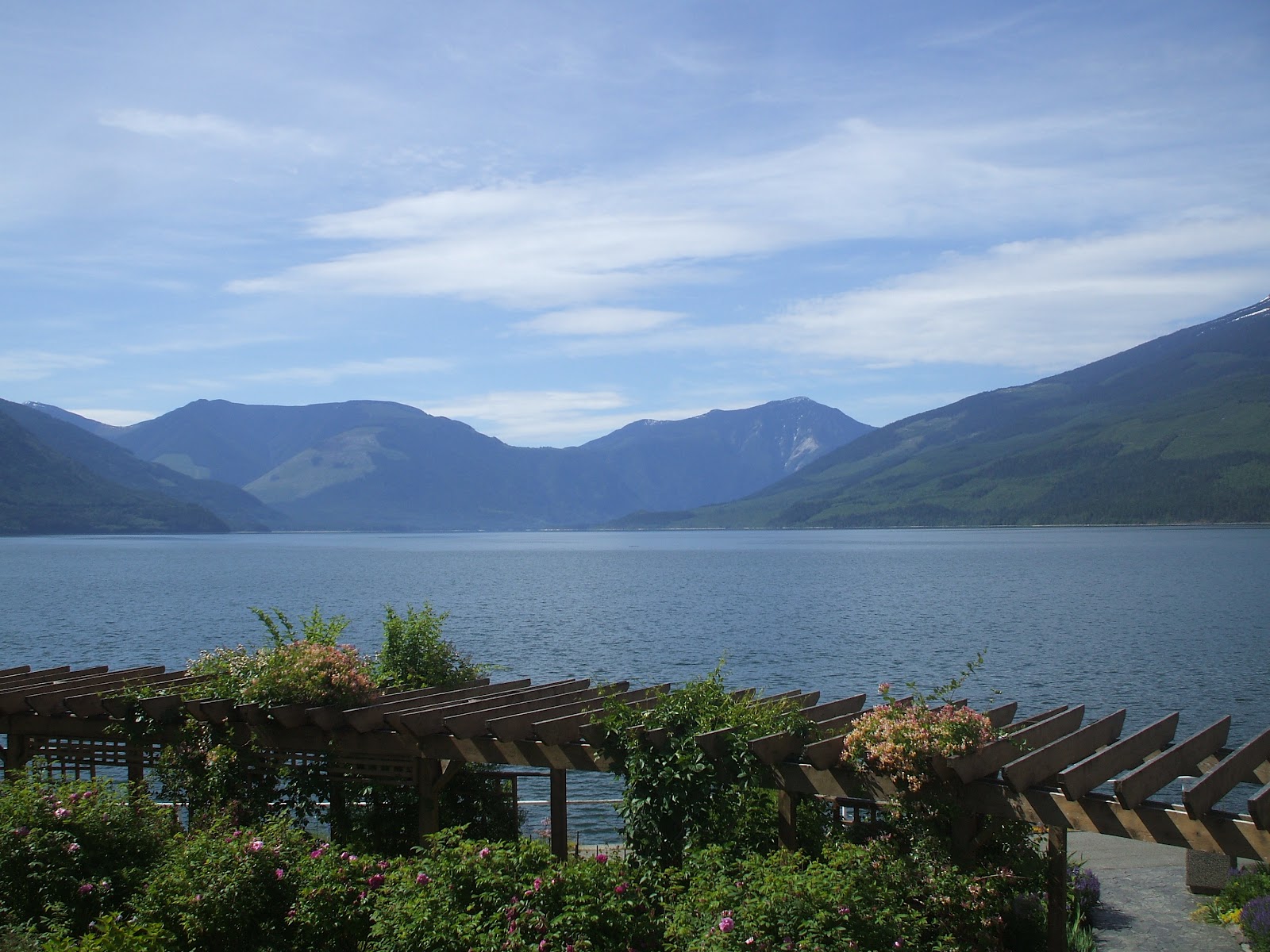
Many years later, now with an adult Andrew and an adult daughter Rosemarie, my wife and I travelled Eastwards from Vancouver. This was a quiet winding route with scenery of staggering beauty. Travel meant crossing a sequence of wooded ridges, each running North-South, with long narrow lakes in the valley floors. We travelled through EC Manning Provincial Park, Penticton, Kelowna (where we ate at an Indian restaurant whose owner was nostalgic for Birmingham), Upper Arrow Lake, and then, on the third day of travel, arrived at Nakusp. This was the perfect British Columbia village, arranged on a small grid plan, with a high street of buildings lined with the kind of wooden facades seen in wild west films.

Nakusp had once been an industrial community, but the lake had been raised and the lakeside industry had been flooded. There were now gardens and a lakeside footpath. The old Leland Hotel (built shortly after the village was established) survived, although rather closer to the lake than it once was. Built in 1892, it is ancient by BC standards. We stayed there and had a view from our bedroom window that people in Switzerland would pay thousands to see.


I wonder if the European Union has any funds for village twinning, so that people from Quintin and my own village of Martley could get to know each other? Nakusp is rather far from Martley, but I intend to visit again as a one-man twinning association.

Friday, 4 March 2011

Dubai: the new Melbourne


I recently spent three nights with my wife in Dubai - two nights out and one night back on a trip to visit my daughter in Melbourne. We stayed on both occasions in the XVA Art Hotel - a wonderful small guesthouse built around an art gallery and a vegetarian café. This is in Al Bastakiya, the oldest part of Dubai, located between to the Creek, the Linen Souk, the al Fahidi Fort, and the Royal Palace. Al Bastakiya is a network of narrow alleys between courtyard houses, each of which has a wind tower - a sort of air conditioning system in reverse, designed to channel cooler winds from the sea down into the rooms of the house. The Creek is lined with dhows and crossed by small open ferries called ‘abras’, which take you across to Deira, which has the gold and spice souks.

This is of course very different from the other Dubai, of gleaming towers and shopping centres, all marble, gold, glass and flash. The most common reaction of visitors to this Dubai is that it is ‘artificial’. This is a strange comment because all cities are the result of human decisions, either by planners, property developers, or the inhabitants themselves. Dubai has been set out in the desert, but many of the world’s great cities were laid out in this way. Melbourne was laid out as a grid in the Australian bush by a surveyor one morning. This must have seemed an unpromising location for a great city, but, as in Dubai, its governors built imposing town halls, government buildings, museums and art galleries, and post offices that befitted the great city they intended Melbourne to become. Over the 150 years since it was planned, the central grid has been adapted. Narrow passages between buildings have become ‘laneways’ - pedestrian streets packed with restaurants and small shops. Trees line each of the broad main streets of the grid, which are wide enough to allow tramlines (and tram stations) down their centre.

Dubai too will change over the next century: people will become familiar with and fond of its iconic buildings; different areas of the City will develop distinct characters; its inhabitants will adapt and humanise its houses and streets; people will become proud of their city and pity those unfortunate enough to live elsewhere. Perhaps they will remember with gratitude the vision and drive of those who founded the city.

Wednesday, 5 January 2011

Climbing up on Woodbury Hill

 Every hill in the English countryside has a name and a history - sometimes several histories. Look North from the crest of the Malvern Hills at the Worcestershire Beacon and you see a long ridge of hills, some with barrow mounds on their crest, and one (Woodbury Hill) with an iron age hill fort. This fort is now covered by a plantation of pine trees, but the steep ditches of the old embankments remain. Through the trees, and along the ridge to the South are some of the greatest views in the English Midlands. East are the great ruins of Witley Court, once the home of the dowager queen Adelaide. Beyond this is the wide valley of the River Severn, and the far hills of the Cotswold edge. West are the folded hills of Herefordshire, on to the Welsh border mountains. North is the long wooded ridge of Abberley Hill and the strange clock tower at Abberley Hall

There are over two thousand hill forts in Britain, but there is uncertainty about when they were built, whether they were occupied throughout the year, and when they fell into disuse. But most are about 2500 years old, and were deserted after the defeat of the native British by the Roman Army. Much later, Woodbury and Abberley Hills were the scene of a great non-battle. In 1405, Owain Glyn Dwr led his Welsh army with its French contingent against King Henry IV. Glyn Dwr’s men camped on Woodbury Hill, facing the English camp on Abberley Hill, across the narrow valley now the site of Great Witley village. No battle took place because both armies were unassailable on their hilltops, and after five days of challenges, Glyn Dwr headed back to Wales.

Over 200 years later, another civil war led to a further gathering on Woodbury Hill. On 5 March 1645, a gathering of a thousand ‘clubmen’ met on Woodbury Hill to pass a declaration which they presented to the Royalist High Sheriff of Worcestershire. The clubmen were local militias which were organised independently of the two sides in the Civil War, with the aim of defending their families and possessions against either army. Eventually, however, they sided with the better-disciplined Parliamentary army, and took to harassing the Royalists.

There have thankfully been no civil wars in England since the 17th century, and Woodbury Hill remains a quiet place to remember great events.
See also:
England's Great Divide Walk

Wednesday, 11 August 2010

England’s great divide walk

Several years ago, I read Stephen Pern’s excellent book, The Great Divide. This described his walk along the watershed between the Pacific and Atlantic Oceans in the USA. He began in the Mexican desert, and followed the crest (or as close to it as he could manage) of the Rocky Mountains to the Canadian border. If he had continued North, passing West of Banff, he would have come to the Columbia Icefield. This glacier is the origin of rivers that flow into three oceans - not just to the West and the East, but also to the North. The main Northbound river is the Athabasca, and you can follow it along a road called The Icefield Parkway, as it descends from a mountain torrent to a wide sweeping river between meadows near the town of Jasper. After Jasper, the river travels hundreds of kilometres North to become part of the River Mackenzie, flowing through tundra into the Arctic Ocean.

The courses of rivers and their watersheds are easy to follow on the maps of a vast empty country like Canada, but much harder in a crowded one like England. So what would be the route of a great divide walk in England? Most people would guess that the Northern section would be close to the Pennine Way. This is generally true, although the watershed actually crosses the Scottish border several miles West of the Pennine Way, near Kielder. From there, it heads South along the boundary between Cumbria and Northumberland, towards Once Brewed near Hadrian’s Wall. The great divide walk would then follow the Pennine Way South to Edale, close to the crest line of the Pennines, across Saddleworth Moor and the High Peak. But what happens after you reach Edale?

Following the map, you can trace a strange circuitous route around the heads of lowland rivers systems. First, you would walk South around the Western edge of the Peak District, near the Roaches, and then across Staffordshire to the West of Stoke and Stafford. From then on, my imaginary long distance path is difficult to trace, as it passes through the Black Country over Frankley Beeches to the Lickey Hills South of Birmingham. From then on, it would swing East and then South in a long arc around the catchment of the Warwickshire Avon, eventually reaching the Cotswold escarpment and the Cotswold Way. You would follow this lovely scenic long distance path for most of its way until a few miles North of Bath. The great divide path would then need to head East around the watershed between the Gloucestershire Avon and the Thames until you reach an area called the North Down near Devizes. This is England’s equivalent to the Columbia Icefield, albeit a low-lying hill without ice. From it, rivers head West to the Atlantic, East to the North Sea, and South to the English Channel.

As human beings moved back into Britain after the end of the last Ice Age, they would have travelled along the dry watersheds to avoid the marshy and tree-clogged valleys. The North Down and the nearby Salisbury Plain would then have been the great junction of this Stone Age transport system. Early inhabitants have marked this busy place with rings of standing stones, white horses carved into chalk hills, barrows and mounds. This is a kind of commercial, political and religious city, but dispersed over several hillsides and occupied seasonally. It would be a superb end to my Great Divide Walk. While I walk it in my imagination, others may do so on foot.

Saturday, 10 April 2010

South Pacific politics


My encounter with New Zealand politics came in Paihia. This is a pleasant town in the far North of New Zealand. It has a subtropical climate (Tangiers is on the comparable latitude in the Northern Hemisphere). There is a small grid of wide streets surrounded by densely-wooded hills  facing an enclosed bay. Ferries cross frequently over the bay to the fine historic town of Russell. On the third side of the bay are the Waitangi Treaty Grounds, where the treaty between the Maori and the British was signed. The date is now commemorated as New Zealand National Day, which in London becomes an occasion for exiled Kiwis to take part in a Circle Line pub crawl.

My family stayed three nights in Paihia in early March this year, in a penthouse apartment in a splendid motel called (rather strangely) the Swiss Chalet Lodge. One day at lunchtime, I walked the few yards down to the waterfront, and then along the sea front to the shops. I stopped at a small booth selling kebabs and ordered one. I chatted to a genial Kiwi and his mate. I learnt he had family connections with my part if England and had visited it. I asked his name and discovered he was Phil Goss, the Leader of the Opposition in the New Zealand Parliament, former foreign minister, former trade minister etc etc. Phil was touring by bus to campaign against an increase in the local version of VAT. ‘Campaigning’ seemed to be a matter of stopping and chatting to people.

This all seemed appropriate for a profoundly egalitarian country like New Zealand. Phil told me that when he was a minister he visited London and was met at Heathrow by an official chauffeur-driven car. As usual, he sat in the front. The driver was horrified and told him that ministers always sat in the back. That says a lot about life in England: some politicians think they are too superior to their drivers to sit alongside them, and the drivers regard their inferior status as right and proper. If you come across a British politician in our general election, look where he sits in the car.

I remember another observation Phil made. He was surprised that people in different parts of England all spoke with different accents. New Zealand has an accent of its own but few if any local variations. I don’t believe this situation will last. The country has a bigger area than the UK but has only four million inhabitants. About a quarter live in Auckland, but the rest are scattered over small cities, towns and villages separated by hills and mountains (and linked by narrow winding roads). There are strong local loyalties: several people in the South Island told me how much more beautiful it is than the North Island; while people I met in Coromandel were keen to prevent people from  Auckland building holiday homes in the Town. Local loyalties mean people try and distinguish themselves from outsiders, and speech is one way to do it. Over the next century, Kiwi ingenuity will create a range of new accents, possibly with even more unexpected vowels than the ones they use at present.

Sunday, 21 March 2010

Memories of the British Empire

The main road running East-West through central Vancouver is called ‘Broadway’. When you drive along it, the names of the streets which cut across it are hung above the road. Driving East after Alma Street, you cross over Collingwood Street and Waterloo Street, Blenheim Street and Balaclava Street, and then Trafalgar Street. Names of the battles and heroes of the British Empire in the 19th Century are found all over Canada, Australia and New Zealand, together of course with streets, parks, gardens, cities and towns and one Australian state named after Queen Victoria herself. They are part of the cultural heritage of Britain, as much as the English language, the rule of law, representative government, fish and chips, and the kilt and the bagpipes.

As British people settled in different lands, they adapted this heritage to take account of the native people and settlers from other countries, the strange new landscape they found themselves in, and the very distance from the mother country. They innovated new ways of building, farming, and governing themselves, and also new ways of speaking English. The most extraordinary adaptation to the lives of the native peoples took place in Canada, where British and French settlers learnt from the First Nations how to survive, travel and trap fur in the vast boreal North of the country. Adaptation to the new landscape came more slowly. For several generations, British settlers tried to make their new land resemble the old - importing plants, animals and pests, and creating gardens of rose bushes and herbaceous borders. Eventually, their descendents came to love and feel at home in the bush, and venerate indigenous trees and animals and national symbols. Their farmers adapted to the opportunities of a warmer climate, and in New Zealand and Australia developed the best wines in the world.

To a visitor like myself, the most striking signs of innovation in Canada, Australia and New Zealand are the towns and the buildings. In all three countries, the smallest communities have very wide streets, often set out in grid. Many have wooden buildings with elaborate facades, while, particularly in New Zealand, shops have ‘verandas’ (canopies over the street to protect the pedestrian from rain and the sun). These superb vernacular building styles are shown below, from Trafalgar Street in Nelson, New Zealand.

For comparison, there is a photograph, below, from the beautiful town of Nelson, British Columbia.


All of these countries settled from the British Isles have subsequently received people from many different lands. But the continuity with Britain remains strong. In 2003, my family visited Eastern Canada and one day came to Fredericton, the capital of the Province of New Brunswick. Fredericton was named after one of the sons of King George III, and was first settled by loyalists moving North after the American Rebellion. It is a small city, noted for its educational institutions and its support of the arts. There is a fine cathedral in English Gothic style facing a provincial parliament building, which, like most parliaments in the former British Empire is Gothic rather than Grecian or Roman in appearance. This is an outward display of the political theory that freedom is based on the continuity of the law rather than abstract reason. I asked to visit the provincial parliament building, and was surprised to find the Provincial Assembly in session. Speeches were bilingual, with each member switching easily between English and French. As I left, an august lady swept from her car to enter the building. She was the lieutenant governor, arriving to sign into law the bills that had just been voted by the assembly. I felt pleased and proud that such a civilised way of life, with its origins in the best British traditions, was maintained so well amidst a vast and beautiful wilderness of forests and mountains.